Earth’s Cryosphere, 2022, Vol. XXVI, No. 5, p. 12-24.
SURFACE AND GROUND WATERS IN TERRESTRIAL PERMAFROST REGION
 ASSESSMENT OF POSSIBLE CONSEQUENCES OF OUTBURST FLOODS: CASE STUDY OF THE BODOMDARA RIVER VALLEY (TAJIKISTAN)
V.A. Iudina (Kurovskaia)1,*, S.S. Chernomorets1, I.N. Krylenko1,2, T.A. Vinogradova3, I.V. Krylenko1, E.A. Savernyuk1, A.G. Gulomaydarov4, I.I. Zikillobekov4, U.R. Pirmamadov4, Yu.Kh. Raimbekov4
1 Lomonosov Moscow State University, Faculty of Geography, Leninskie Gory 1, Moscow, 119991 Russia
2 Water Problems Institute, Russian Academy of Sciences, Gubkina St. 3, Moscow, 119333 Russia
3 Research and Production Association Gidrotekhproekt LLC, Oktyabr’skaya St. 55a, Valdai, Novgorod oblast, 175400 Russia
4 Branch of the Aga Khan Agency for Habitat in the Republic of Tajikistan, Rudaki Ave. 34, Dushanbe, 737450 Tajikistan
*Corresponding author; e-mail: viktoriiakurovskaia@gmail.com
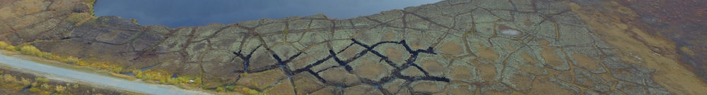
The prerequisites and modeling of possible outburst floods in the valley of the Bodomdara River (Tajikistan) are considered using detailed field data. According to the route survey results, Upper Bodomdara Lake is a supraglacial lake, which assumes possibility of its outburst leading to a cascade outburst flood. The depression of Lower Bodomdara Lake is relatively stable, and its outburst is possible without cascade flooding at anomalously high temperatures, upon snowmelt combined with extreme rainfall. Two probable scenarios are considered: (I) the outburst of Lower Bodomdara Lake (its volume comprised 328,000 m3 according to the bathymetric survey of 2020) and (II) the cascade outburst flood of Upper Bodomdara Lake (700,000 m3). Digital elevation model (DEM) ALOS PALSAR (12.5 m) and DEM based on images from an unmanned aerial vehicle for the Bodomdara River alluvial fan were used for predicting flood consequences. The outburst flood hydrographs for scenarios I and II were obtained using the lake outburst model developed by Yu.B. Vinogradov and an empirical formula, respectively. The material increment was estimated in the transport-shift model of debris flow formation. The resulting hydrograph was applied for zoning the Bodomdara and Shakhdara river valleys with a total length of 75 km based on the FLO-2D model. According to the modeling, the maximum water discharge at the top of the alluvial cone of the Bodomdara River will reach 143 m3/s under scenario I and 348 m3/s under scenario II.
Keywords: outburst floods, debris flows, transport-shift model, FLO-2D model, model of lake outburst, Tajikistan
Recommended citation: Iudina (Kurovskaia) V.A., Chernomorets S.S., Krylenko I.N., Vinogradova T.A., Krylenko I.V., Savernyuk E.A., Gulomaydarov A.G., Zikillobekov I.I., Pirmamadov U.R., Raimbekov Yu.Kh., 2022. Assessment of possible consequences of outburst floods: case study of the Bodomdara River valley (Tajikistan). Earth’s Cryosphere 26 (5), 12–24.